
AI summary
Summary of article:
WSJ reported that China is accelerating mapping of the waters around Taiwan and could support a blockade of Taiwan and counter US military intervention; Taiwan is simultaneously building more research ships and unmanned vehicles to strengthen its defense.
wall Street The daily reported on the 30th that China has stepped up mapping of the waters around Taiwan and sent dozens of ships to collect data, which can help submarines and underwater unmanned vehicles navigate and locate enemy targets if conflict erupts in the Taiwan Strait, and enhance China’s ability to seize Taiwan.
In response to China’s recent intensive maritime survey activities, Taiwan launched two new research ships in August to strengthen survey and mapping of this potential maritime battlefield. Additionally, it invested resources in building a maritime unmanned vehicle force to strengthen its defense capabilities.lai qingde The President said at the launch ceremony of the new ship: “Only by having a thorough understanding of our own marine environment can we maintain national security and jointly protect the maritime order with the international community.”
However, China is far ahead in ocean survey, shipbuilding and unmanned vehicle force development. In recent months, Chinese research vessels have been particularly active in the waters east of Taiwan, which include waters that the U.S. Navy would have to cross if it intervened in the conflict in the Taiwan Strait. The Wall Street Journal analyzed ship tracking data and found that Chinese ships move back and forth like lawn mowers in large areas of water south and east of Taiwan, helping Beijing slowly complete the survey and mapping of the waters around Taiwan.
The Coast Guard said the activities of mainland research vessels contribute to “battlefield readiness.” The Taiwan Affairs Office of the State Council did not respond to questions about mainland marine survey activities. Brian Clark, a senior fellow at the Hudson Institute, a think tank in Washington, said China hopes to have detailed marine topography data to aid the operation of submarines and underwater unmanned vehicles. These devices could be used to blockade Taiwan or prevent the United States from intervening in conflicts in the Taiwan Strait.
Although Chinese research vessels are prohibited from entering Taiwan’s coastal waters, giving Taiwan the advantage in surveying and mapping these waters, Beijing has made oceanography a national strategic priority, investing resources in building research vessels and advanced underwater unmanned vehicles. Analysts say Chinese research vessels are also used to document the location of undersea communications cables, which could become another target during a conflict.
“They’re trying to understand the distribution of undersea infrastructure because they probably want the ability to cut off Taiwan’s external communications in an overwhelming operation,” said Clark, who served in the U.S. Navy’s submarine force.
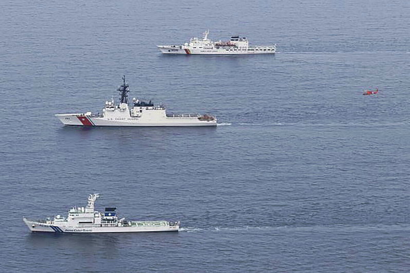
Japan and the Philippines have continued to strengthen defense cooperation in response to potential threats posed by Beijing, and announced in May that they would begin talks on overlapping maritime boundaries in waters east of Taiwan. China’s marine survey activities around Taiwan subsequently increased significantly. China criticized the talks between Japan and the Philippines as illegal and launched a series of coast guard exercises to bolster its sovereignty claims.
Alan Zhang, a research fellow at the Heritage Foundation, a US think tank, who has studied China’s research ship activities, said China is using the maritime boundary talks as an excuse to do what it probably wanted to do in the first place, which is to increase pressure on Taiwan. He said Beijing has long tried to find legal cover for its gray zone strategy, and “the research ship fits this model perfectly.”
Summary FAQ
-
These can collect seafloor and waterway data to help maritime survey submarines and underwater unmanned vehicles detect and locate targets during conflict, and could be used to blockade Taiwan, cut communications or prevent US forces from intervening, the report said.
-
Taiwan launched two new research ships in August, strengthened surveying and mapping of surrounding waters, and also invested resources in building a maritime unmanned vehicle force. Lai Qingde stressed that a thorough understanding of the marine environment is an important foundation for safeguarding national security.
-
The article reports that China’s maritime surveillance around Taiwan has significantly increased and is seen as using gray zone tactics to exert pressure. The outside world believes that Beijing may use the Japan-Philippines talks as an excuse to increase pressure on Taiwan and strengthen its sovereignty claims.