

AI summary
Summary of article:
New York’s mild weather this week will turn to cool and wet conditions over the weekend, with temperatures falling into the mid-40s, along with rain, scattered snowfall in higher elevations, strong onshore winds and a slight risk of flooding.
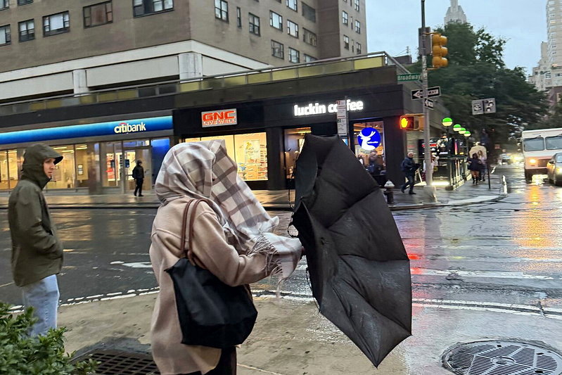
This week’s mild weather is coming to an end in the New York area, and the weekend is going to be much cooler. As the low pressure system brings wind and rain and cold air from the north moves south, temperatures are expected to drop into the low 40s from the 13th (Friday) through the 15th (Sunday). Citizens will experience a sudden change from autumn weather around 60 degrees Fahrenheit to wet and cold days with wind and rain, so they will need to bring extra clothes and umbrellas when going out.
According to forecasts from the National Weather Service (NWS), this wave of weather change is caused by a low pressure system moving eastward from the Ohio Valley. The system is expected to pass through the southern New York area during the afternoon to evening of Thursday, the 12th, and remain off the coast throughout the next day, and then slowly move away to the northeast. The period with the most potential for rainfall is from the afternoon of the 12th to the afternoon of the 13th, and may continue into the morning of the 14th (Saturday). Moderate to locally heavy rain may occur in some areas.
Places with higher chances of snowfall are mainly concentrated in inland highland areas. The snowfall time includes from late night on the 12th to early morning on the 13th, and from late night on the 13th to early morning on the 14th. The weather service expects little or no accumulation even if wet snow develops.
Brian Siemnecki, a researcher with the National Weather Service, said temperatures in the New York area so far this year have been slightly warmer than last year, but that can’t be used to conclude that extreme cold won’t return this winter.new york city In February this year, the government reported seven deaths in private residences from hypothermia-related causes, and at least 15 outdoor deaths believed to be directly related to hypothermia.
In terms of temperature, after the cold air moves from the north to the south, the temperature will drop above 40 degrees Fahrenheit from the 13th to the 15th (Sunday), which is about 10 to 15 degrees lower than this week’s average; It is expected to exceed 50 degrees on the 16th (Monday) and 17th (Tuesday). Although the weather will gradually become dry next weekend, northwesterly winds will still blow, and the autumn cold will be more obvious.
Coastal residents are also advised to pay attention to the tides. During daytime high tide on the 12th and 13th, minor flooding may occur in some coastal areas. The inner bays on the southern coast of western Long Island and the southwestern coast of Connecticut are more vulnerable. The highest wind gusts are expected to reach 25 to 30 mph at many locations along the New York City, Long Island, and Connecticut coasts by the evening of the 12th to 13th.
The Municipal Housing Preservation and Development Bureau determines that the heating season is from October 1 each year to May 31 of the following year. From 6 a.m. to 10 p.m., when the outdoor temperature is below 55 degrees Fahrenheit, the indoor temperature should be at least 68 degrees; From 10 pm to 6 am, regardless of the outdoor temperature, the indoor temperature should be at least 62 degrees. If the heating is inadequate, you should first contact your landlord. If your complaint is not resolved, you can complain by calling 311.
Summary FAQ
-
Influenced by a low pressure system and cold air moving from north to south, New York’s 60-degree autumn heat will quickly turn to wet and cold days with wind and rain through the weekend. The temperature will drop significantly. It is important to keep rain gear and warm clothes ready while going out.
-
The highest probability of precipitation is from the afternoon of the 12th to the afternoon of the 13th, and may continue into the morning of the 14th; Snowfall is more likely in inland highland areas from late night on the 12th to early morning on the 13th and from late night on the 13th to early morning on the 14th.
-
Minor flooding may occur in coastal areas during daytime high tides on the 12th and 13th, as well as gusty winds of 25 to 30 mph. If indoor heating is inadequate, you should contact your landlord first. If it does not improve, you can call 311 and complain.